AERIAL INSPECTIONS
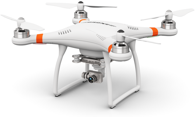
Drone serves as the inspector’s eyes as they can see where naked eye can’t reach like on the top of telecom towers, and wind turbines. The drone is sent to collect visual data that the inspector then reviews to locate damages that require repair.
By using a drone for inspections, it will in turn mitigate safety issues.

There are multiple benefits of drone inspections:
- Reduced risk and savings on liability insurance due to the inspectors not being exposed to dangerous situations.
- Savings because of not building temporary structures such as scaffoldings solely for inspections.
- Savings due to no downtime in areas such as nuclear power plants or pressure vessels that need to be shut down before inspection.
- Due to the low costs of drone inspections, more inspections can be carried out, which leads to greater safety.
AERIAL PHOTOGRAPHY & VIDEOGRAPHY
Sugu’s drones are equipped with high-resolution sensors and cameras for professional cinematography and photography. Now a day’s drones are used for different and versatile purposes like tourism promotions, event coverage’s, advertisements, and motion photography in sports. They can enhance the client satisfaction by setting high standards by delivering them top-notch panoramas, images, and video tours.
REAL ESTATE PHOTOGRAPHY & VIDEOGRAPHY
Sugu drones gives an outstanding real estate photography and video that will help you to sell your property at much better rates. By using this you can easily built up your portfolio that will cover all the aspects of your land. Drone will add extra dimensions to your property. Sugu drones will provide the best and beautiful aspects of property through aerial view, which you can’t achieve through pictures. When these videos are combined with footage on the ground, the overall effect is breath-taking. This provides your buyers the opportunity to make an informed decision based on property. Videos of high-profile properties can be shot and displayed without any human interference. As a result, real estate companies investing in drone technology can easily outsmart competitors who are still following traditional marketing methods.
CONSTRUCTION SITE MONITORING & ANALYSIS
Sugu drones are specialized in providing more reliable, regular and

on time reports, identifying problems efficiently. Sugu drones enables contractors to provide services regarding construction companies by delivering 3D modeling, digital elevation modeling and Ortho mosaics data. They can be used to inspect onsite stockpiles and aggregates, fencing, and other safety conditions while ensuring crew members’ safety. Those companies who want work efficiently can have project monitoring services. You can compare project quality with data gained to ensure project cost reduction and provide minimal delay, by completing regular drone imagery flights. It’s cheaper than traditional survey equipment by reducing surveying times to hours instead of days and months.
MAPPING & PHOTOGRAMMETRY
Aerial surveying and mapping with drone photogrammetry enable us to yield survey-grade 3D maps and models. It enhances productivity by alleviating efficacy and decreasing operational costs since operators must spend less time on the field. It gives exact results and easily repeatable data. When needed maps and models can be updated at low costs.
PRECISION AGRICULTURE
In conventional method it would take hours to walk in filed for inspection but Sugu drones programs are providing ease for farmers to save and manage time as they can look after their crops, livestock and deliver quick visual data on crops. For the understanding of irrigation techniques, we use 3D maps of farmlands. For precision agriculture drones can help us to maintain the crops and soil by looking at their required nutrients and minerals for maximum growth. It helps us to frequently investigate the soil health. The increased efficiency offered by drones ensures crop yield and productivity. Sugu drone system provides the farmers with multidimensional imaging sensors to maintain crops, soil, fertilizing and irrigation more efficiently. This advantage both the farmers and the wider environment by curtailing the use of fertilizers, water waste management and at the same time increasing the yield from crops. Multidimensional Images is a very operative tool for estimating soil productivity and analyzing plant health. The health of your soil and crops with the naked eye is very limited and reactionary. Multispectral sensor technology sees what the farmer is not able to and it provides easy to interpret data.
PUBLIC SAFETY AND DRONE CONSIDERATION
Search and rescue

Sugu systems has known the importance of using high- quality instruments for search and rescue operations and drones are best for them. As they have high coverage for large area and when equipped with thermal imaging can make situation idea for searches at night.
Primary Security Line patrols
Sugu drones can provide patrols along property and shorelines using thermal imaging at night to identify heat signatures on your property
4
Private Parties,
Ceremonies, Weddings


Travel Vlogs,
Commercials & Videos
Outside Venues,
Concerts, Festivals

We Use Twin Engine With HD Camera
To Get The Best Results
That’s more than twice the range.


